Consign Your Best Items with Lelands. We Also Pay Cash on the Spot! Learn More Here.
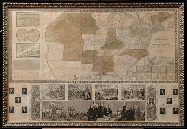
Circa 1846 United States Map Ensign's Engravers
This is a scarce wall map version of Phelps & Ensign's important traveler's guide. It portrays the United States as far west as the Black Hills of the Missouri Territory depicting stage, steamboat, canal and railroad routes. Thirteen small inset maps detail the vicinity of major cities, with two other insets of upper Maine and the Florida Peninsula. At left are a small double hemisphere world map and comparison charts of the mountains and rivers of the world. Other features of the map include several historical vignettes including the landing of the pilgrims, the battle at Lexington, the battle at Bunker Hill, Washington's farewell to his army and the signing of the Declaration of Independence, the text of the Declaration of Independence, and portraits of ten presidents. It is incredibly well preserved and conservatively graded as EX+, with no signs of restoration. Framed to 29.5x41".
Past Sports Card, Memorabilia, Non-Sports Card and Collecitble Auction Items
Other past auction items that may be of interest to you.

1904 Ringling Brothers Art in Original Frame (21x27" framed)
19th Century Trade Card Collection
Turn of the Century Huebach Figurines with Marklin Bicycles
1954 Ernest Hemingway Original Photographs (9)

Handcarved Wooden Black Boy On Watermelon (35" tall)

Westinghouse Mazda 1932 Jackie Cooper Die-cut Sign
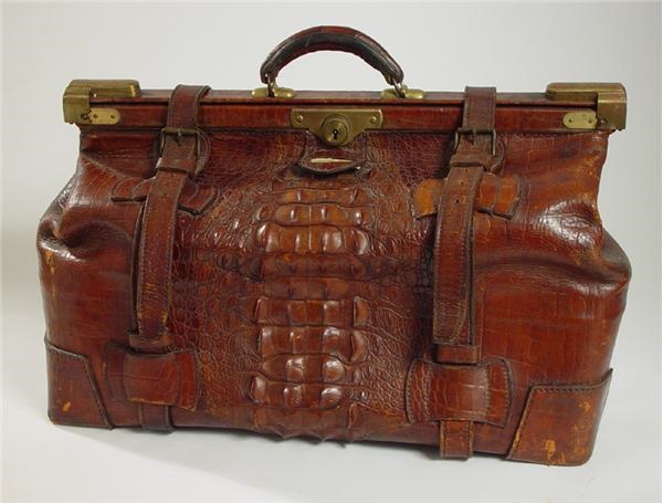
19th Century Alligator Suitcase